US Route 1 runs 81 miles through Maryland, from the District of Columbia line near Hyattsville north to the Pennsylvania border at Rising Sun. It is not the scenic route. Most of that stretch is commercial corridor, divided highway, strip mall, and traffic signal. But Route 1 in Maryland has always been the working road, the road that connected the colonies before anyone built an interstate, and the towns along it carry that history in layers. Jim Henson built Kermit the Frog at the University of Maryland on Route 1. A stone railroad viaduct built in 1835 still carries trains over the Patapsco River a quarter mile from where the highway crosses it. Bald eagles by the hundreds gather at Conowingo Dam each winter because the Susquehanna River below the spillway is the best fishing they’ve found. None of this is obvious from the road. You have to stop.
Route 1 Through Maryland: 81 Miles from DC to Pennsylvania
Before Route 1 had a number, it had a name: the Kings Highway, then the Boston Post Road, then the Atlantic Highway. King Charles II ordered it laid out in 1673 to connect Boston with Charleston. The 1704 Act of the Province of Maryland required counties to build roads 20 feet wide — wide enough for a horse-drawn carriage to pass. That road became Route 1.
Today the highway enters Maryland from the District of Columbia at Hyattsville and runs north through College Park, Laurel, Savage, Elkridge, and Baltimore before continuing up through Bel Air and Harford County to the Susquehanna River crossing at Conowingo. I-95 runs parallel the whole way, so Route 1 has lost its role as a through-route. What it kept is the towns. Every community along Route 1 in Maryland owes its location to this road, and most of them still wear that fact plainly.
College Park: Kermit the Frog’s Birthplace
Route 1 passes directly through the University of Maryland’s front door in College Park. Jim Henson was a student here in 1955 when he created Kermit the Frog for a local television show called Sam and Friends. The original Kermit was built from a ping-pong ball and a discarded coat. The University of Maryland on Route 1 is also home to the College Park Aviation Museum, built on the grounds of the world’s oldest continuously operated airport, opened in 1909 by Wilbur Wright himself.
The Thomas Viaduct: Oldest Multi-Arch Stone Railroad Bridge in America
Just off Route 1 in Elkridge, the Thomas Viaduct has carried trains across the Patapsco River valley since 1835. It is the oldest multiple-arched stone railroad bridge in the United States and, according to engineers who have studied it, one of the most elegant. Eight granite arches span 700 feet. The bridge curves slightly, which was a structural innovation at the time and remains rare. Trains still cross it. On any given day, Amtrak or freight traffic passes over stone laid when Andrew Jackson was president.
Bel Air and Harford County: Route 1’s Small-Town Stretch
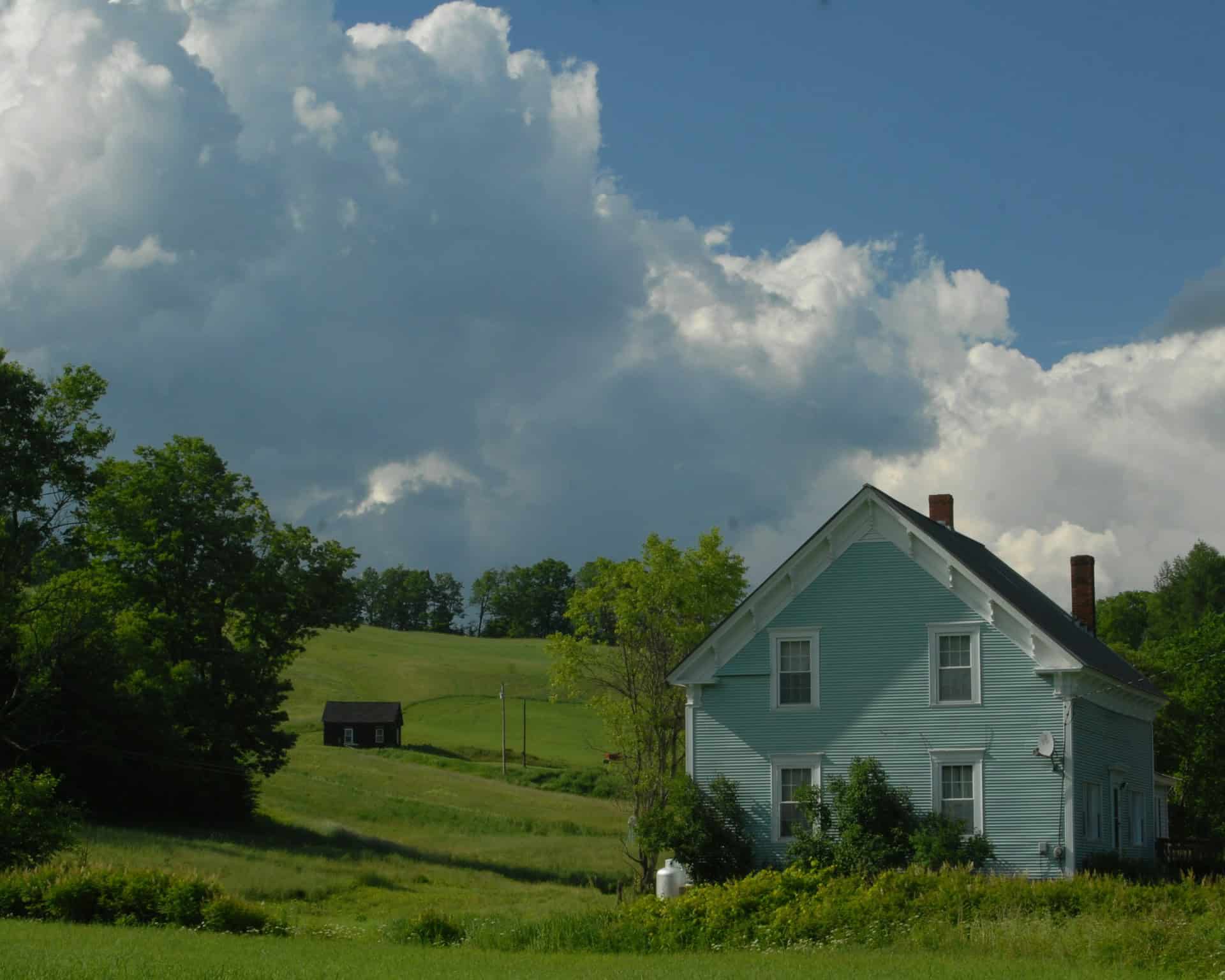
North of Baltimore, Route 1 leaves the urban grid and becomes Main Street in Bel Air, the Harford County seat. The historic district along Main Street is exactly what Route 1 towns looked like before the interstates — antique shops, independent restaurants, a courthouse, a farmers market. Route 1 continues north through Forest Hill and into Rocks State Park territory, where Deer Creek cuts through forested hills and the King and Queen Seat overlook at 190 feet above the valley floor is the best view in this part of the state.
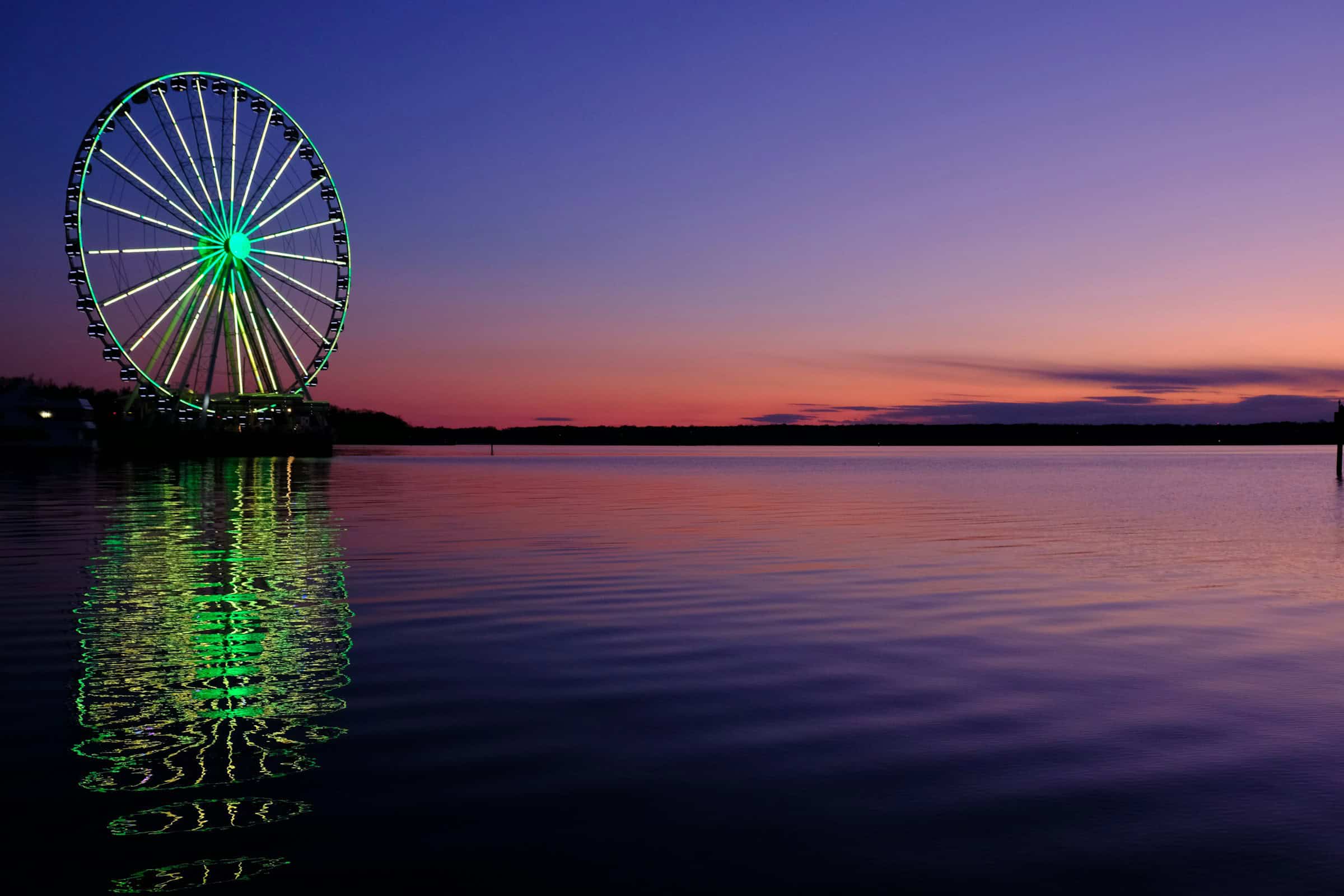
Conowingo Dam: Route 1’s Most Dramatic Crossing
Route 1 crosses the Susquehanna River on the Conowingo Dam, a 94-foot-tall hydroelectric dam completed in 1928. The crossing itself is matter-of-fact: a two-lane road on top of a working dam. What makes it worth stopping for is what happens below. When the spillway gates open, the churning water stuns fish and pulls them to the surface, drawing bald eagles from across the mid-Atlantic. November and December are peak season, when 50 to 400 eagles have been counted on a single day at Conowingo. Photographers drive from multiple states for this. The overlook at Fisherman’s Park gives a clear view of the action below the dam.
The Chesapeake Bay: Maryland’s Defining Geography
The Chesapeake Bay is the largest estuary in the United States, with 11,684 miles of shoreline and an average depth of just 21 feet. It splits Maryland into two distinct regions: the Eastern Shore and the Western Shore, each with its own culture and character. Sixteen of Maryland’s 23 counties and Baltimore City border on tidal water. The Bay’s drainage basin covers six states and Washington, D.C., and its rivers — the Susquehanna, Potomac, Patuxent, and Patapsco — created the peninsula-and-cove geography that Route 1 skirts along its Eastern Shore approach.
The Eastern Shore, isolated for generations by the Bay and poor roads, developed its own accent and way of life. Smith Island and Tangier Island are documented as having some of the most preserved Elizabethan English dialects in the country. The isolation that preserved the language also maintained the economy: crabbing, oystering, and farming, passed down through families rather than inherited from corporations.
The Blue Crab and What It Means Here
Maryland’s seafood industry contributes $600 million to the state’s economy annually, with commercial landings averaging over 56 million pounds per year. But the blue crab is not primarily an economic fact — it’s a social one. A Maryland crab feast means newspapers on the table, wooden mallets, Old Bay by the pound, and steamed crabs that you pick yourself. The ritual is communal and slow. Tourists struggle with crackers; locals use a butter knife and their hands. The argument about technique is the conversation. You eat for three hours and argue about which crab house is best. No one agrees. That is also part of the ritual.
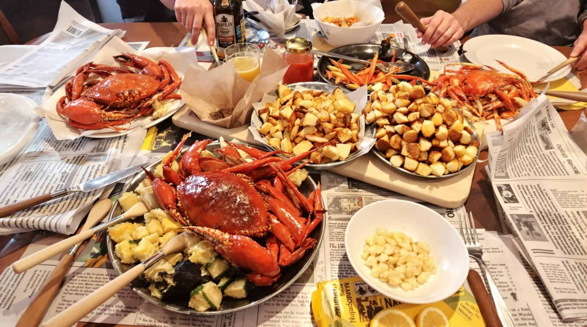
Traditional Maryland crab feast spread
The industry has structural problems. Labor shortages, overfishing, and cheaper imported crabs from South America have pushed century-old Maryland operations out of business. The H-2B visa lottery that supplies seasonal workers is a bottleneck the industry has never solved. One Eastern Shore crabber requested 54 workers for a season and received zero. The crabs are still here. The pickers are disappearing.
Baltimore on Route 1
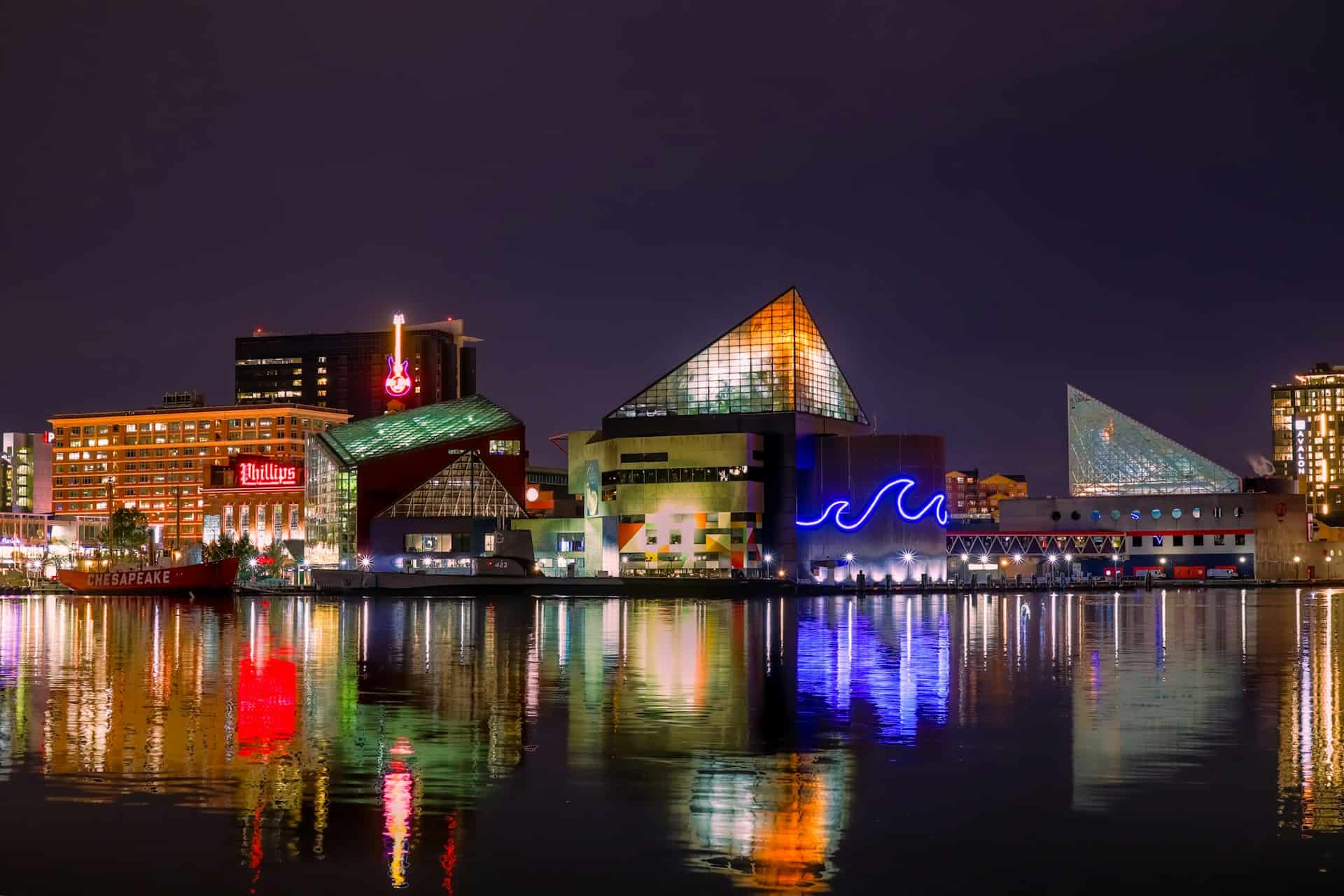
Route 1 enters Baltimore from the south and threads through a city that contains more contradictions per block than most states manage per county. Johns Hopkins Hospital and blocks of boarded-up rowhouses. Million-dollar Inner Harbor condos and working-class neighborhoods where the same families have lived for four generations. Frederick Douglass was born in Talbot County on the Eastern Shore and made his way to Baltimore as a boy. H.L. Mencken spent his entire career here, calling it the only American city worth living in. The Ravens take their name from Edgar Allan Poe’s most famous poem, because Poe died here in 1849 under circumstances still debated.
The Baltimore accent turns “water” into “wooder” and appends “hon” to most sentences. It is not put on. Travel to Southern Maryland and Tidewater inflections appear. Head west to the Appalachians and the vowels shift again. Maryland has never had one accent because it has never been one place.
Poe’s Baltimore
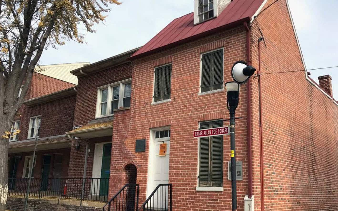
Edgar Allan Poe House Museum on Amity Street in Baltimore
Poe arrived in Baltimore as an infant in 1809, five weeks old, on a visit to his paternal grandparents. He came back repeatedly throughout his life. In the 1830s, writing from the rowhouse at 203 Amity Street, he won first and second place in a Baltimore Saturday Visiter fiction and poetry contest. He made contact with the Southern Literary Messenger there and built a career from it. The house is now a museum. The city named its NFL team for his most famous poem. The poem is about a raven, not a football team, but Baltimore has always absorbed its history and made it useful.
Historical Anchors Along the Corridor
The Battle of Antietam: September 17, 1862
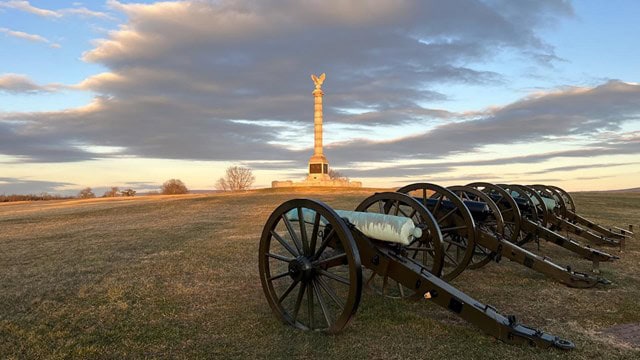
Antietam battlefield
The Battle of Antietam on September 17, 1862 is the bloodiest single day in American military history: 22,727 dead, wounded, or missing. Robert E. Lee’s Army of Northern Virginia and George McClellan’s Army of the Potomac fought to a draw in fields near Sharpsburg, just west of Route 1’s Maryland corridor. The outcome was tactically inconclusive and strategically decisive. Lincoln used it as the victory he needed to issue the Emancipation Proclamation five days later, transforming the war from a fight to preserve the Union into a fight to end slavery. Maryland, a slave state that stayed in the Union, provided the stage for that turn.
The battlefield is accessible from I-70 and Route 40, about 15 miles west of the Route 1 corridor. The Sunken Road — Bloody Lane — and Burnside Bridge look much as they did that morning. The NPS has kept the farmland largely intact. Walking those fields, you can work out the terrible arithmetic: nearly 23,000 casualties in an area smaller than most shopping centers.
Maryland’s Founding: The Catholic Colony That Wasn’t
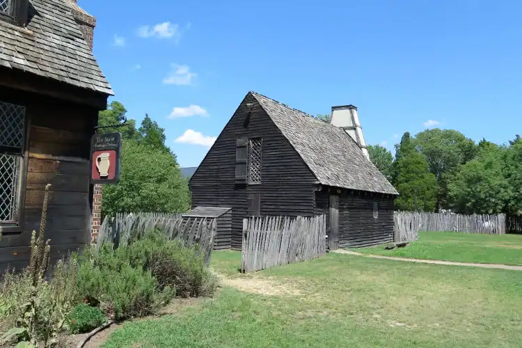
Historic St. Mary’s City reconstruction
George Calvert applied to Charles I for a colonial charter to establish a haven for English Catholics. Calvert died in April 1632 before it was granted. His son Cecilius received the charter on June 20, 1632, and his younger brother Leonard led the first expedition, landing at St. Clements Island in the lower Potomac in March 1634. The colony was immediately outnumbered by Protestant settlers. The Calverts managed the tension through religious tolerance policies formalized in the 1649 Act Concerning Religion, which granted freedom of worship within Trinitarian Christianity. By 1692, the experiment was over: Anglican establishment, Catholics marginalized in the colony their family had chartered.
Annapolis: Where Washington Resigned
The Maryland State House in Annapolis has been in continuous legislative use since 1772, making it the oldest state capitol in the country still serving that function. Its wooden dome, the largest in America built without nails, was completed in 1788. In the Old Senate Chamber in December 1783, George Washington resigned his commission as commander-in-chief of the Continental Army. Two weeks later, the same room was used to ratify the Treaty of Paris, officially ending the Revolutionary War. Annapolis became the state capital in 1695 when royal Governor Francis Nicholson moved the seat from St. Mary’s City and renamed Ann Arundell Town in honor of Princess Anne.
Route 1: The State’s Eastern Thread

81 mile of Route 1 run through Maryland
Route 1 in Maryland is paralleled by I-95, the Baltimore-Washington Parkway, US 29, and US 301. It lost its role as a long-distance route decades ago. What it has instead is density: Route 1 passes through College Park, Laurel, Savage, Elkridge, Baltimore, Bel Air, and a dozen smaller communities that exist because the road was there first. The highway remains congested because it is still the main street for the towns it runs through.
The road’s margins document American transportation history. Abandoned motor courts along the Laurel stretch were built for travelers before motels standardized the industry. Art Deco diners still serve coffee to truckers and commuters. In Elkridge, the Thomas Viaduct carries Amtrak over the Patapsco on arches built in 1835. In College Park, a plaque marks where Wilbur Wright first instructed Army Signal Corps officers in 1909. In Bel Air, the main street is Route 1 and has been since the town existed.
What Maryland’s Geography Actually Means
Maryland is called “America in Miniature” because the geographic range is absurd for 12,407 square miles. Backbone Mountain in Garrett County reaches 3,360 feet. Ocean City sits at sea level on a barrier island. The distance between them is four hours by car. The western mountains have continental winters, with recorded lows of -40°F and heavy snowfall. The Eastern Shore has a maritime climate that moderates temperatures but still freezes the Bay’s northern tributaries most winters. USDA hardiness zones run from 5b in the Appalachians to 8a on the lower Eastern Shore.
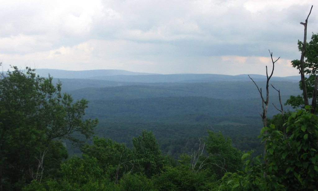
View of Backbone Mountain, Maryland’s highest point, with rolling Appalachian ridges in background
Three geographic zones shape the state. The Atlantic Coastal Plain, bisected by the Chesapeake Bay, covers the Eastern Shore and most of the western shore below Baltimore. The Piedmont Plateau, broad rolling upland with river gorges, runs from Baltimore’s suburbs west to the Catoctin Mountains. Beyond that is the Appalachian region: South Mountain, the Great Valley, Allegheny Front, and Garrett County’s high plateau. Route 1 runs entirely through the Coastal Plain and the lower Piedmont. The mountains are another trip.
Islands in the Bay
Skipjack sailboat off remote Chesapeake Bay island
Smith Island sits in the Chesapeake Bay, accessible only by ferry from Crisfield. Its three villages — Ewell, Rhodes Point, and Tylerton — are connected by narrow roads through marsh. The main industries remain crabbing and oystering, handed down through generations. The island’s famous Smith Island cake, with eight to twelve thin layers, originated as watermen’s wives sending food to their husbands working the Bay. The island is slowly disappearing. Rising sea levels are eroding the marshland that protects it, and the population has dropped from several hundred to fewer than 250. Holland Island, once home to 360 residents, is already completely submerged.
Caves and Forgotten Places
Crystal Grotto Caverns in Boonsboro were discovered in 1920 and are described as having more formations per square foot than any other cavern in the world. The cave maintains a constant 54 degrees year-round, and daily tours run through chambers of stalactites and flowstone. On the Chesapeake and Ohio Canal towpath at mile marker 75.7, Killiansburg Cave is a 2.5-mile walk from the parking area, a dark opening in sandstone bluffs above the Potomac. In Ellicott City, the ruins of the Enchanted Forest, a storybook-themed amusement park that ran from 1955 to 1995, sit along nature trails, fairy tale structures being slowly reclaimed by second-growth forest. Tobacco barns stand empty in Southern Maryland fields now growing subdivisions, their ventilated walls designed for a crop that built the colony but depleted the soil.
Share your Maryland route 1 memory
Do you have a story you would like to share? We want to hear it!
Create a View to tell a unique story about a specific place
Want to see what others wrote about Maryland?
Our Travel map has over 1400 posts from users like you
We have 2 types of content at Route1views:
- View: A unique experience at a single location
- Trip: A collection of experiences at different places, connected through a ‘road trip’
- Most first-time posters choose to make a View
A note about Route 1 Views
We are a user-driven social media site for celebrating and sharing stories along historic Route 1 USA. Using our platform is FREE forever and we don’t play any tricks. We don’t share your data or spam you with emails. We are all about sharing!

Driving Route 1 through Maryland from the DC line to the Susquehanna is not a scenic experience in the way that Maine or the Jersey Shore is scenic. It is a working corridor, built for commerce and still carrying it. But the Thomas Viaduct is still there, and the eagles are still at Conowingo, and Kermit the Frog was invented on this road. Maryland has been working out what it means to be American since 1634, and Route 1 has been present for most of that argument. You will not see all of it from the car. If you want to drive it, our 3-day Maryland road trip guide covers the full corridor stop by stop.

The Route 1 Road Trip Coloring Book
36 pages · 13 states · a color-as-you-drive map. Free — print it at home.
36 pages · no email required · print at home
Want a peek inside first? See everything →It's yours — enjoy! 🖍️
No email, no strings. By the way — want the occasional Route 1 story and first dibs on the next freebie? Totally optional.
You're in — thanks! 🖍️
 Continue with Google