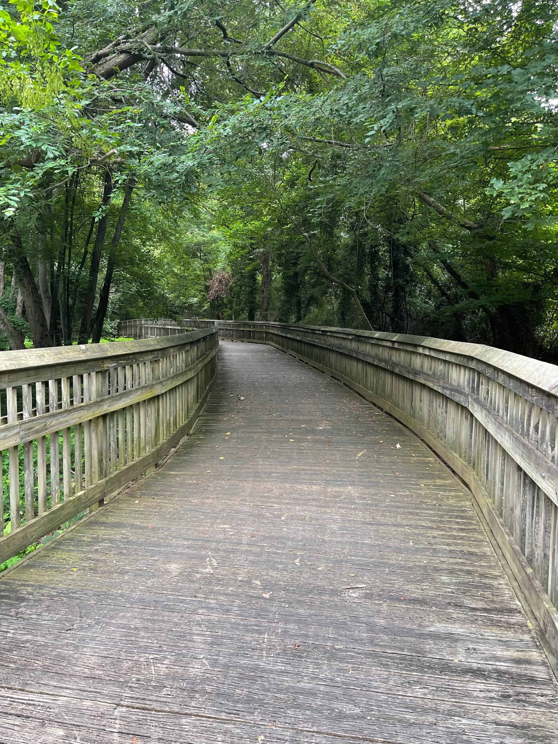

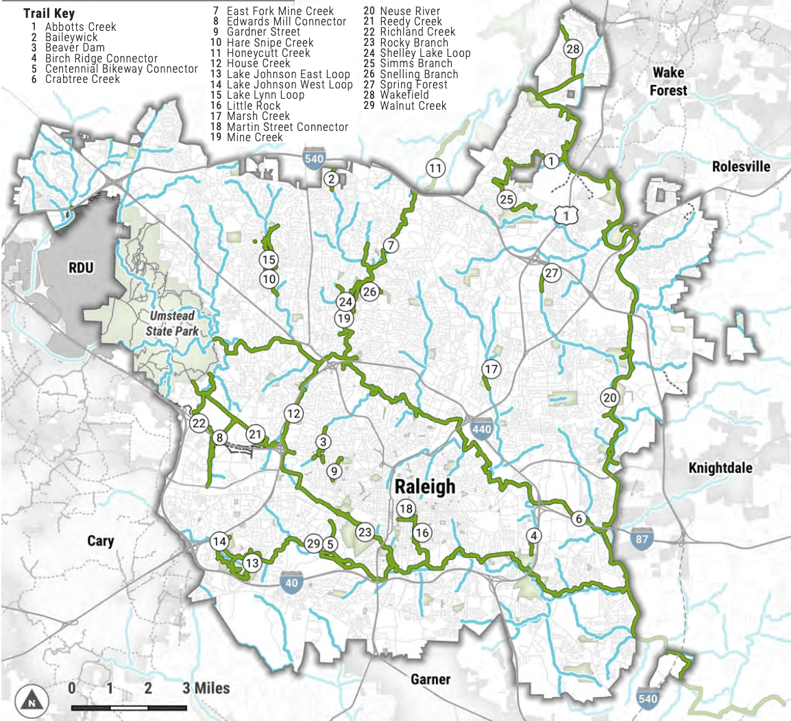
Raleigh has a greenway network of 117 miles of trails through its metropolitan area. Many of the trails like the Walnut Creek Trail were built in the 1980s and 1990s. The trails incorporate an impressive infrastructure of boardwalk areas over wetlands, roadway underpasses, and independent bridges around railway abutments. These trails aren’t just glorified sidewalks that require you to stop and go at each pedestrian crossing! They are almost fully separated from vehicular traffic, making them safe and seamless for miles at a time. Part of my ride took me along the I-40 Beltline where it follows Walnut Creek, which was the longest uninterrupted stretch I encountered.
The first Capital Area Greenway (CAG) Master Plan was created in 1976 when the population of Raleigh was 139,000. The Greenway was creatively envisioned as a way to connect people to Raleigh’s 200 parks, to encourage fitness and health, and even to provide alternative transportation for commuters and shoppers. The CAG System has been maintained and expanded over the years by Raleigh’s Parks, Recreation and Cultural Resources Department. For almost half a century, the system has connected people across Raleigh and has established the city of half a million residents as home to one of Route One’s best networks of “linear parks” for biking and recreation.
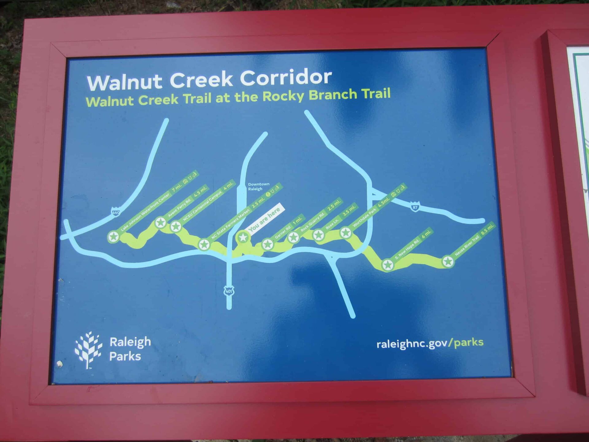
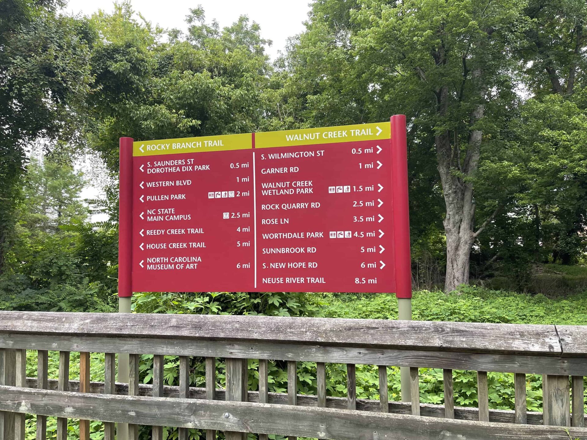
Signage along Walnut Creek is generally good. Maps were provided at major trailheads and intersections. Intermediate mileage markers were less consistent. They were there every 1/4 mile in a few areas but were completely absent in others. The newly approved Master Plan for the CAG mentions the need for more signs with direction and distance indicators to trailheads and points of interest. The signs could use a little consistency in style, color and appearance, too.
Like the presence of mileage markers, the condition of the trail surface was variable, but generally very good. All of that bridge and boardwalk infrastructure takes effort and money to maintain! Unsurprisingly. there were crews working to improve a few areas that I traversed. I rode at mid- morning on a fairly hot July weekday, and I was discouraged by the sparse traffic on the trail. Hey, I had it to myself for the most part- no complaints there- but I’m always stoked when I’m around others getting their exercise in a park.
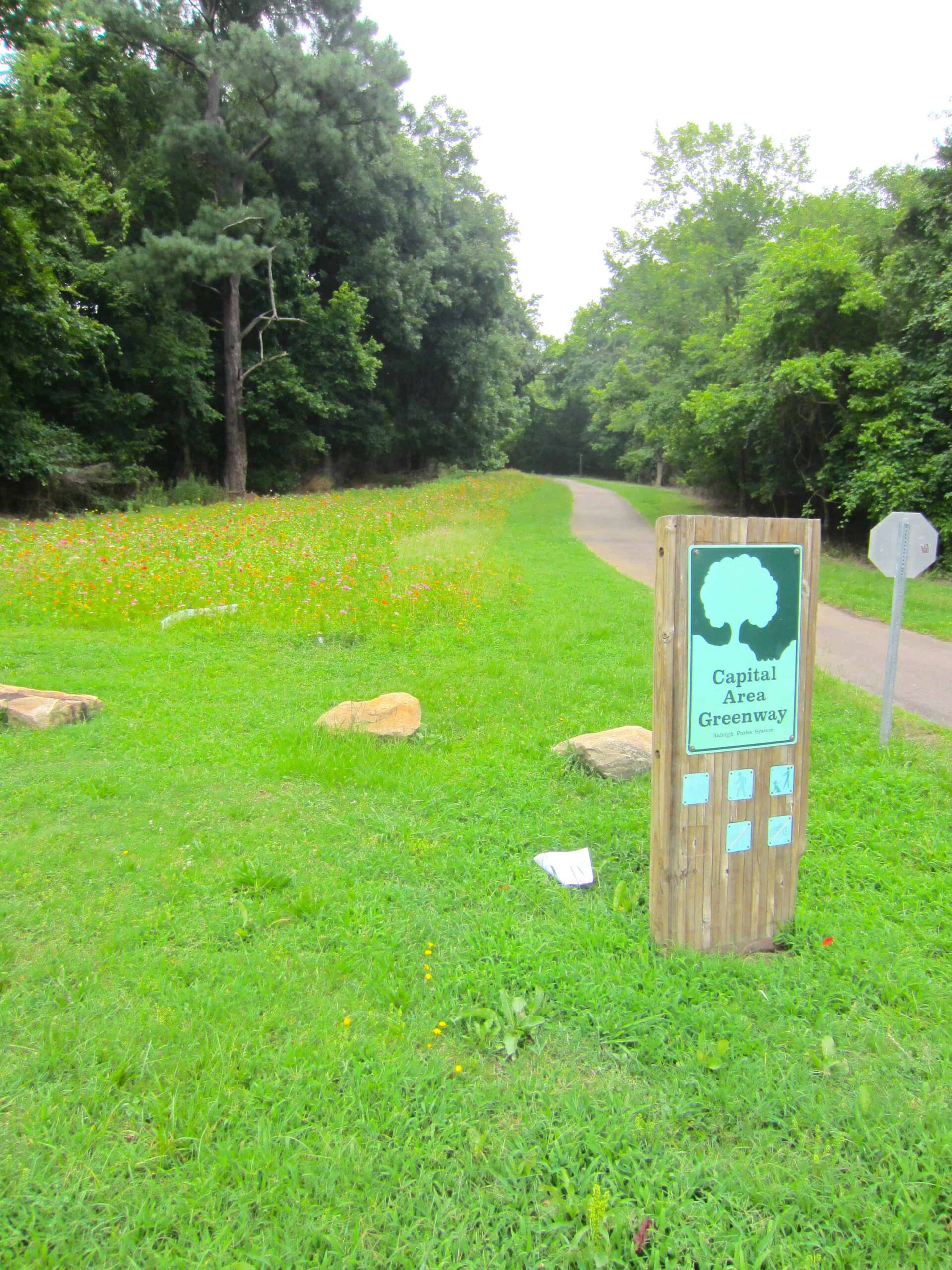
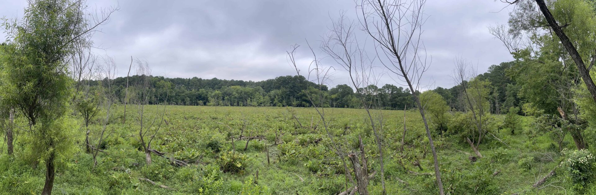
The flora and fauna were surprisingly good! There were a few planted wildflower areas, a large marshland where I spotted a great blue heron doing some fishing, and a wealth of lovely mixed woodland where you could hear songbirds in the canopy. Okay, I passed the water treatment plant, but I think that’s almost obligatory for a bike trail along a waterway in a city. The art deco Ernest Bain Water Plant building was kinda cool for Raleigh – a throwback to 1939 when Raleigh’s population was less than 50,000 and Route One went down Hillsborough Street!


 Continue with Google