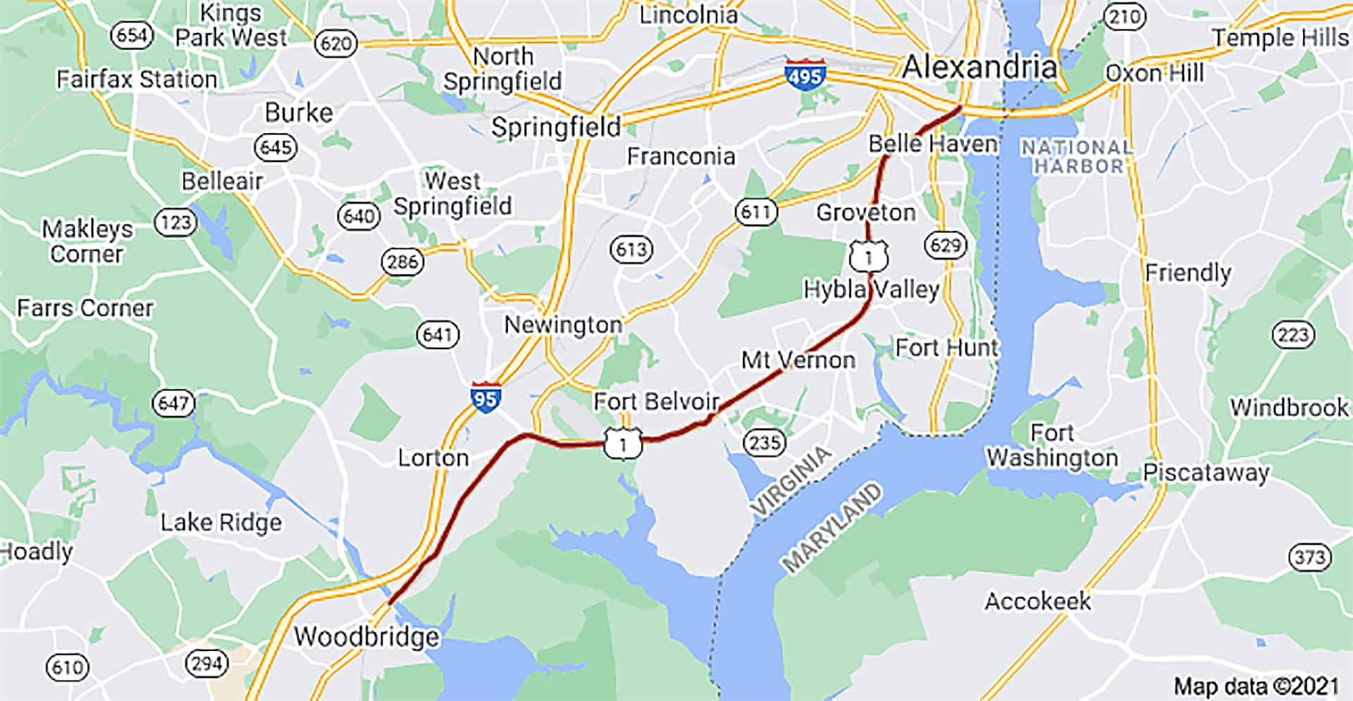
The attached two 6-minute videos provide a brief history of Richmond Highway in Fairfax County, Virginia. The development of Richmond Highway (U.S. Route 1) tells the history of the Fairfax County area.
Discover the old Potomac Path that George Washington and the Founding Fathers used. Explore early airfields that competed to be the largest airport in the area. Learn about the history of southeast Fairfax County in this short account.
Some highlights from the video:
“The history of Route 1 is really a history of Southeast Fairfax County. It started as an Indian Path in the 1600s, and as the colonial settlers moved North from Jamestown and Northern Neck, they followed that path to the north and used it as sort of the center of their activity. It served the plantations along the Potomac River, but subsequent settlers built their homes and their churches, and later their schools, along the path. All this is the predecessors of Route 1.”
“…the most surprising was airports. The biggest one was in Hybla Valley. It was called the George Washington air Junction and it in the 50s almost competed with Dulles to be a large airport outside downtown Washington area. It ultimately closed.
Although it was a naval training and flight training facility in World War II and is now Huntley Meadows Park. And for you residents that wonder why that street is named Lockheed Boulevard is because it ran from route one over to the Lockheed hangers…”
Chronology of Richmond Highway
– 1600s: Started as an Indian Path.
– Colonial era: Settlers moved north, using the path as their activity center, serving plantations along the Potomac River.
– Subsequent years: Settlers built homes, churches, and schools along the path, the predecessor of Route 1.
– Revolutionary War period: The path was central to Virginia’s first families, including the Fairfax Family, George Masons, and Washingtons.
– During the Revolutionary War: Generals Rochambeau and Washington used the path to move south to Yorktown.
– 1840s: Quaker families moved to the area, bought Woodlawn, and undertook agricultural and road-building projects.
– Before World War I: The Army bought land for Camp Humphreys and paved the Acton Turnpike with concrete in 1918.
– Post-World War I: Development along Route 1 included airports, with George Washington Air Junction being a notable example.
Richmond Highway, or Route 1, in Fairfax County, has a cool story that goes back a long time. Starting as a path made by Native Americans, it was later used by people like George Washington. Later, it became a big road that people and cars use every day. There used to be a big airport nearby that almost became as big as Dulles Airport, but it closed down.
Now, when we drive on Richmond Highway, we’re traveling on a road that has lots of history. It shows us how things change over time and how this road has been a part of many important events in the area.


 Continue with Google