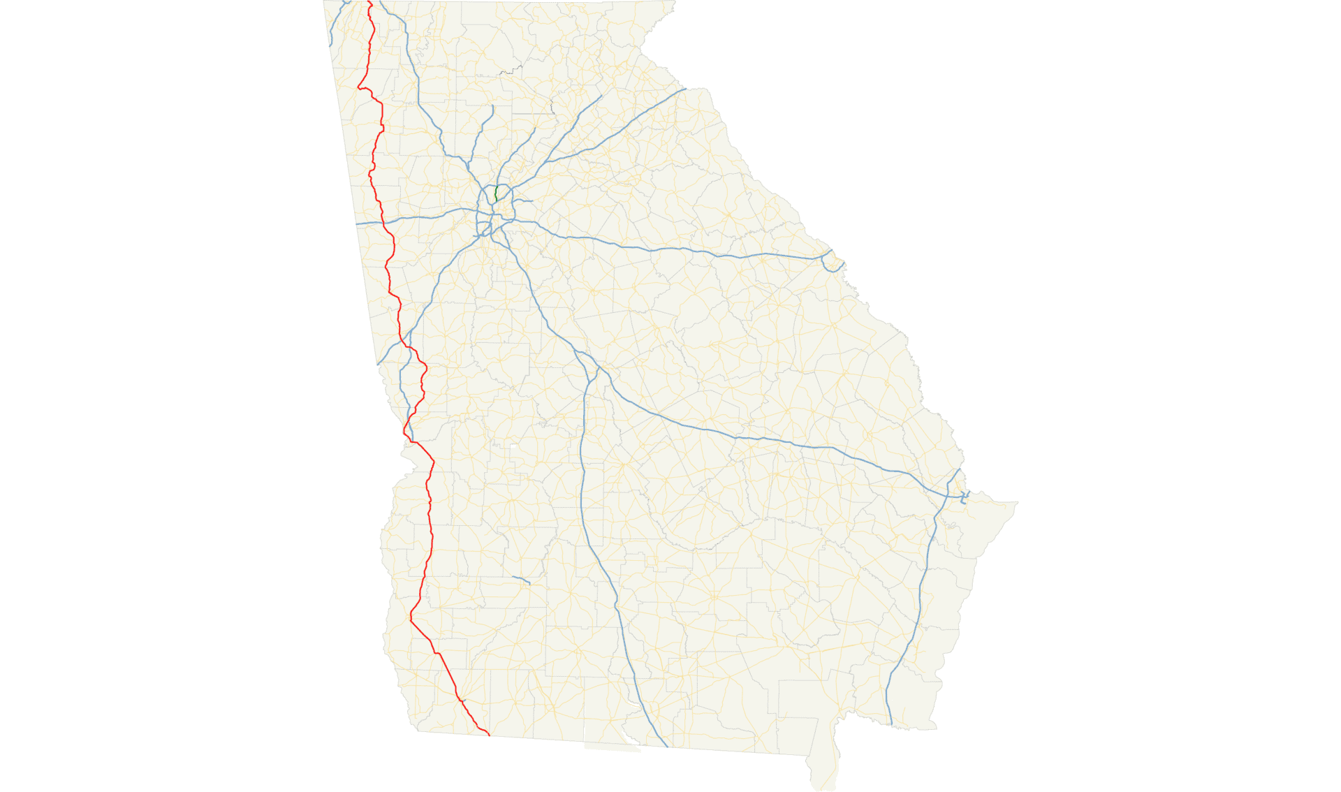
U.S. Route 1 takes the road less obvious through Georgia. While tourists follow I-95 to Savannah’s squares and River Street, Route 1 cuts inland from the South Carolina border near Augusta and runs south-southwest through 250 miles of piney woods, swamp edge, tobacco country, and small towns that haven’t changed much since the highway was designated in 1926. Folkston sits at the Florida line. Augusta anchors the north. Between them: Waycross, Alma, Baxley, Lyons, Swainsboro, Louisville, Wrens, Waynesboro. These are the towns Route 1 connects. None of them are on the tourist circuit. That’s the point.
The routing decision that set this up happened in the 1920s. Highway planners assigned Route 1 to an inland path through Georgia rather than following the coastal alignment via Savannah. The result is a corridor that runs along Georgia’s Fall Line, the geological boundary where the Piedmont drops to the Coastal Plain, through country that grew cotton and naval stores and timber and now grows blueberries and Vidalia onions. It’s a different Georgia than the one on the postcards, and it’s worth knowing.
Route 1 Through Georgia: The Corridor
Augusta: The Northern Anchor
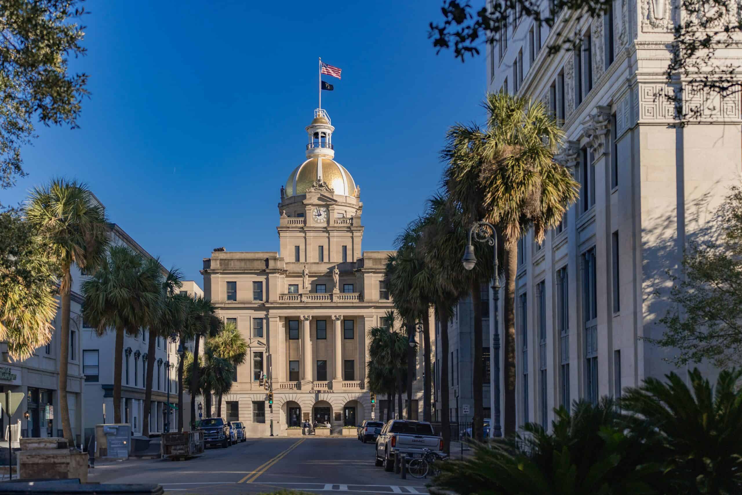
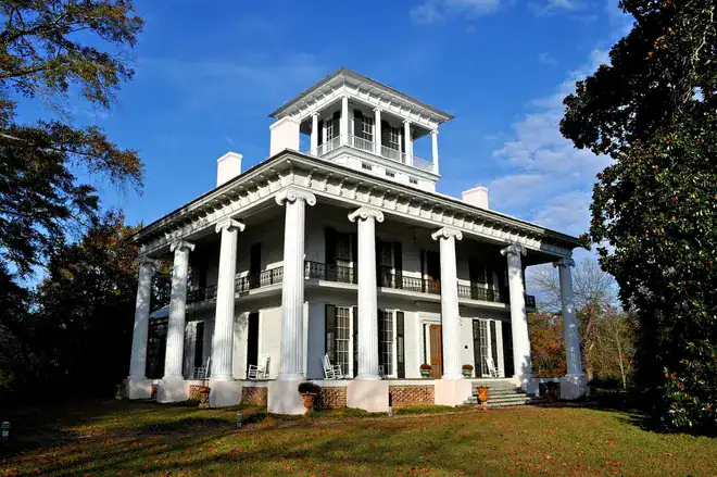
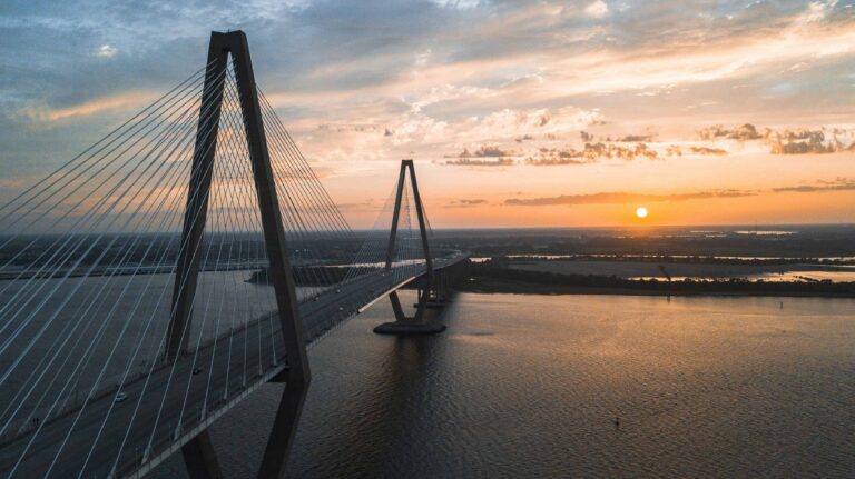
Route 1 enters Georgia from South Carolina at Augusta, crosses the Savannah River, and immediately places you in one of the state’s most historically loaded cities. Augusta was founded in 1736 and served as Georgia’s second colonial capital. James Brown was born here in 1933. The Masters Tournament has been played here every April since 1934 at Augusta National, a course built on a former nursery by Bobby Jones and Clifford Roberts. Fort Eisenhower, formerly Fort Gordon, hosts the Army Cyber Center of Excellence, making Augusta one of the military’s primary cyber security hubs. The Augusta Canal, dug in 1845 to power textile mills, is now a National Heritage Area where you can kayak the same channel that drove Georgia’s industrial economy for a century.
The Riverwalk along the Savannah River connects the Augusta Museum of History to a strip of restaurants and bars. The boyhood home of Woodrow Wilson sits on Seventh Street. Broad Street runs through downtown with the kind of broad, tree-lined scale that Southern cities planned for carriages. Augusta rewards a full day. Most Route 1 travelers give it an afternoon. Both are fine.
The Fall Line Towns
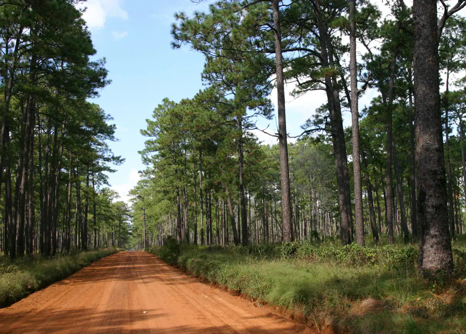
South of Augusta, Route 1 passes through Waynesboro and into the flat, sandy terrain of the Coastal Plain. The towns thin out. The road straightens. Pine forests fill the gaps between county seats. This is the Georgia that Route 1 was built through: agricultural communities with courthouses at their centers, railroad depots either converted or collapsed, and the kind of deep-porched houses that suggest the pace of life was never determined by the interstate.
Louisville, the town Route 1 passes through in Jefferson County, was Georgia’s state capital from 1796 to 1807. The Old Market House still stands downtown, a brick structure from 1796 that served as the center of commerce for the early republic’s southernmost state. It has a contested history that Louisville doesn’t shy away from. The Jefferson County Courthouse museum covers it plainly.
Swainsboro and the Pine Belt
Swainsboro sits in Emanuel County in the middle of the Georgia pine belt. George L. Smith State Park, twelve miles south, protects a cypress-studded mill pond that looks like it belongs in a Faulkner novel. The old wooden bridge at the mill has been photographed so many times that locals barely notice it anymore. Visitors always stop. The Pine Tree Festival runs every May. The paddling on the mill pond is exceptional in the early morning when mist sits on the water.
Lyons and Vidalia Onion Country
Lyons sits in Toombs County, and Toombs County is where the Vidalia onion comes from. The specific combination of low-sulfur soil and climate in a twenty-county zone around Lyons produces onions that are mild enough to eat raw. The Vidalia Onion Museum in nearby Vidalia tells the story of how this became a federally protected designation in 1989. Harvest runs April through June. Roadside stands appear along Route 1 with piled-high bags for a few dollars. Buy more than you think you need. They keep.
Alma: The Blueberry Capital
Alma calls itself the Blueberry Capital of Georgia and backs it up. Bacon County, which Alma anchors, grows a significant portion of Georgia’s blueberry crop. The Alma Blueberry Festival runs in late June. Between May and July, farms along Route 1 and the surrounding county roads offer pick-your-own operations. The Coastal Plain’s sandy, acidic soil is blueberry-ideal. Most of the production goes to commercial buyers, but what ends up at the roadside stands is worth stopping for.
Waycross: Gateway to the Okefenokee
Waycross is the largest city on Route 1’s Georgia corridor and the primary access point for the Okefenokee National Wildlife Refuge. The Okefenokee covers 400,000 acres of blackwater swamp, cypress forest, and open prairies in the southeastern corner of Georgia. Alligators are common. Sandhill cranes and wood storks nest here. The water stains brown from tannins released by decaying vegetation, and the reflections it creates are worth the drive alone. Okefenokee Swamp Park, on the north end of the refuge, runs boat tours through cypress corridors where the canopy closes overhead. The Southern Forest World museum in Waycross documents the naval stores and timber industries that ran this region for a century.
Folkston: The Southern Gateway
Folkston sits at the Florida border and serves as Route 1’s southern terminus in Georgia. It’s also one of the best railroad-watching spots in the country. CSX’s main line between the Southeast and the Northeast runs through Folkston, and the convergence of two major tracks creates what railfans call the Folkston Funnel. The city built a viewing platform specifically for train watchers, with rocking chairs, a gazebo, and a scanner tuned to the railroad frequency. On a busy day, a hundred trains pass through. The Okefenokee National Wildlife Refuge entrance is a few miles west on US 23/SR 177, giving Folkston dual status as both a railroad hub and a swamp gateway.
The History Route 1 Carries
Before the Highway
Georgia was founded in 1733 as the last of the original thirteen colonies. James Oglethorpe’s original design banned slavery, lawyers, and hard liquor. The slavery ban lasted until 1750, when colonial economics overwhelmed the idealism. What followed was plantation agriculture built on rice in the coastal region and cotton in the interior. The Mississippian cultures that preceded European contact built earthen mounds at Etowah and Ocmulgee that rivaled anything in pre-Columbian North America. Etowah Mounds, outside Cartersville, are some of the best-preserved in the Southeast.
The Civil War arrived at Georgia’s doorstep in 1864. Sherman’s March to the Sea cut a sixty-mile-wide swath from Atlanta to Savannah, burning supplies and infrastructure that the Confederacy needed to continue fighting. The fall of Atlanta in September 1864 secured Lincoln’s reelection. The march ended at Savannah in December. Along Route 1’s corridor, markers near Swainsboro indicate where Sherman’s columns passed through the pine belt.
Civil Rights Geography
Georgia was central to the Civil Rights Movement in ways that went far beyond Atlanta. Martin Luther King Jr. was born in Atlanta in 1929, established the Southern Christian Leadership Conference there in 1957, and is buried there. His birth home on Auburn Avenue, Ebenezer Baptist Church where he preached, and his crypt at the King Center are all within walking distance in the Sweet Auburn neighborhood. The Student Nonviolent Coordinating Committee also operated out of Atlanta. The geography of the movement was, in large part, Georgia geography.
Gullah Geechee Coast
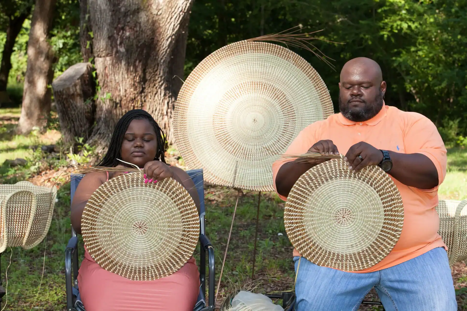
The Georgia coast, east of Route 1’s corridor, preserves one of the most intact African-descended cultures in the United States. The Gullah Geechee people are descendants of enslaved West Africans who worked the Sea Island rice and indigo plantations. The geographic isolation of the barrier islands allowed their language, foodways, and traditions to survive in ways they didn’t on the mainland. The sweetgrass baskets woven on the Georgia and South Carolina coasts trace directly to West African basket-making traditions. The ring shout, a counterclockwise circular spiritual practice, survived here when it was suppressed or forgotten elsewhere. Route 1 runs inland of this culture, but Savannah, two hours east of the corridor, is its urban center.
What Georgia Produced
Music
Augusta’s James Brown invented a rhythmic vocabulary that became the foundation of funk. Macon’s Little Richard and Ray Charles, both Georgia-born, fused gospel and blues into what became rock and roll and soul. The Allman Brothers Band, from Macon, built Southern rock into a genre. R.E.M. came out of Athens in 1980. Outkast came out of Atlanta in 1992. The through-line from Brown to Outkast is real and it runs through Georgia. Ray Charles’s recording of “Georgia on My Mind” became the official state song in 1979, thirty-six years after Hoagy Carmichael wrote it, and the recording itself holds up.
Literature
Flannery O’Connor grew up in Milledgeville and wrote two novels and 31 short stories before lupus killed her in 1964 at 39. Her work, set in the Georgia Piedmont she knew, is among the best fiction produced by any American writer. Alice Walker was born in Eatonton in 1944 and wrote “The Color Purple” in 1982. Joel Chandler Harris created the Uncle Remus stories in the 1870s and 1880s while working for the Atlanta Constitution. Georgia writers have a consistent quality: they understand that the South’s beauty and its horror are not opposites.
Food
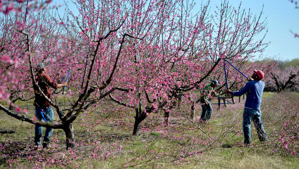
Georgia is ranked first in the nation for pecan production, covering more than 144,000 acres. Albany calls itself the Pecan Capital of the World. Georgia leads in peanut production and is among the top producers of cotton, watermelons, and blueberries. Poultry accounts for roughly a third of the state’s farm commodities. The famous peaches, despite the state’s nickname, rank behind many of these crops economically. The Peach State label stuck because it sounds better than the Poultry State.
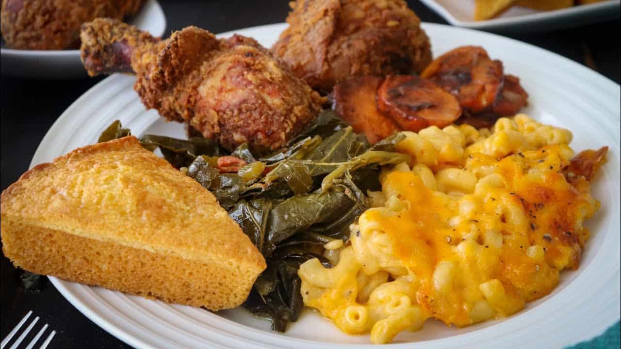
Pimento cheese, boiled peanuts from roadside kettles, Brunswick stew, grits with shrimp, fried chicken with hot sauce: Georgia’s food traditions are African, Native American, European, and increasingly Latin American and Asian. The best version of each usually comes from somewhere without a sign on the road.
Route 1: Small Town Chronicles
Following Route 1 through Georgia is reading the state’s autobiography in asphalt. The highway connects communities that interstate travelers skip entirely, places where the gas station attendant knows your family and the local diner cooks vegetables with ham hocks the way they’ve been cooked here for seventy years.
Each town tells the same basic story with different details: a courthouse square from the county’s founding, a railroad depot that explains why the town exists where it does, a main street that thrived on cotton or tobacco or naval stores and then contracted when those economies shifted. The Route 1 corridor through Georgia is American economic history made physical.
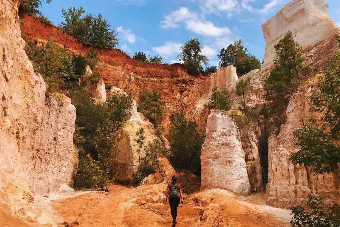
Providence Canyon
Providence Canyon shouldn’t exist. The canyon walls of red, orange, pink, and white banded sediment look ancient, but they’re a product of poor farming practices in the 1800s. Erosion gullies created by inexperienced agriculture cut into the soft Coastal Plain soil and kept cutting. The state park protects what is now a 1,000-acre canyon system that photographers call Georgia’s Little Grand Canyon. It’s off Route 1 in Stewart County, about sixty miles west of the corridor, but worth the detour.
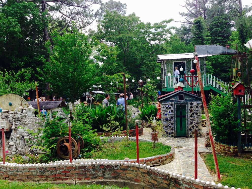
Paradise Garden, Summerville
Howard Finster was a Baptist preacher in Summerville who started building Paradise Garden in 1976 after receiving a vision. The garden grew into 4.5 acres of concrete sculptures, bottle trees, painted totems, and religious text worked into every surface. REM used his paintings on their album covers. Talking Heads collaborated with him. The garden is north of Route 1’s corridor, in northwest Georgia, but it’s the kind of place that reorients your understanding of what American folk art can be.
Getting On Route 1
Route 1 enters Georgia from South Carolina on the Augusta side, crossing the Savannah River on the bridge that connects North Augusta to downtown Augusta. From there, southbound on Route 1 means following US 1 through Augusta’s urban core and then south through Waynesboro, Louisville, Wrens, Swainsboro, Lyons, Baxley, Alma, Waycross, and Folkston to the Florida line. The full corridor is about 250 miles.
Northbound travelers coming from Florida pick up Route 1 at Folkston and work their way up through the same towns in reverse. Either direction, the drive takes two days at a minimum if you’re stopping. Three days is right. The road trip itinerary covers the corridor in detail, with overnight recommendations at Alma and Swainsboro or Waycross.


The Route 1 Road Trip Coloring Book
36 pages · 13 states · a color-as-you-drive map. Free — print it at home.
36 pages · no email required · print at home
Want a peek inside first? See everything →It's yours — enjoy! 🖍️
No email, no strings. By the way — want the occasional Route 1 story and first dibs on the next freebie? Totally optional.
You're in — thanks! 🖍️
 Continue with Google