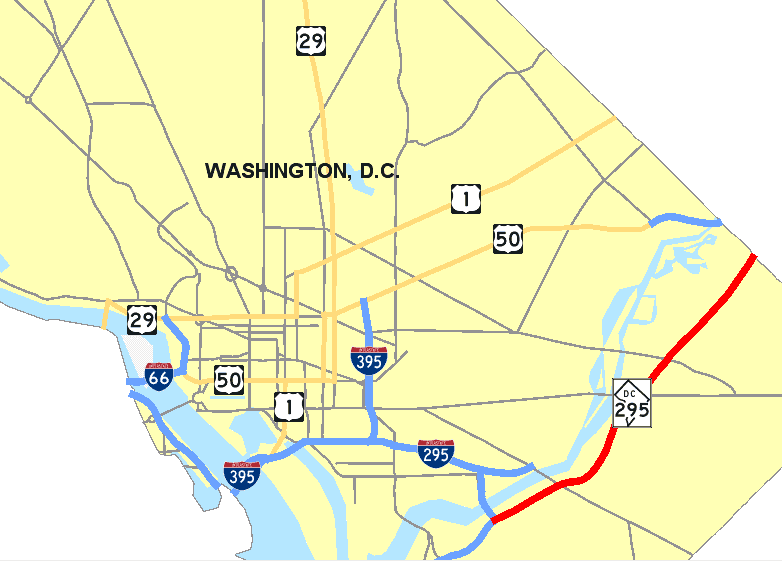
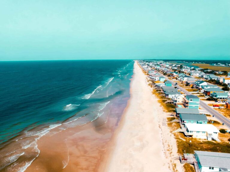
US Route 1 doesn’t bypass Washington, DC — it goes straight through the middle of it. The highway enters from Virginia over the 14th Street Bridge, runs north through the monumental core as 14th Street NW, then exits toward Maryland as Rhode Island Avenue NE. For anyone driving the full length of Route 1, DC is the corridor’s symbolic center: the city that every road leading up and down the eastern seaboard ultimately radiates from. This is where the highway crosses the most storied ground in the country, and where a layover of two or three days rewards you with more than most cities deliver in a week.
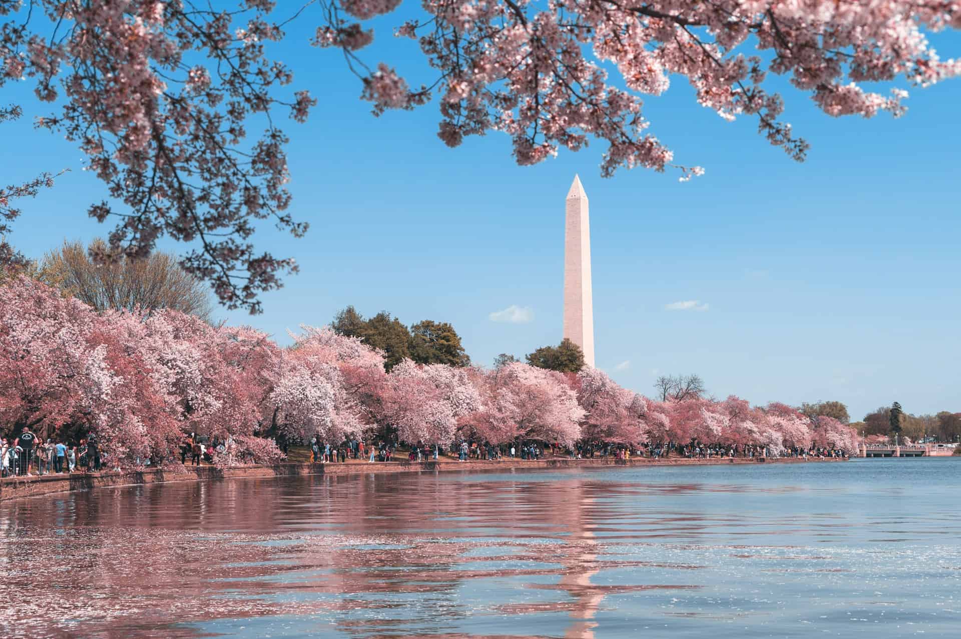
DC is also unlike any other Route 1 stop because the free stuff outranks the paid attractions by a wide margin. The Smithsonian museums, the National Mall, the monuments, the national memorials: all free. The city charges you for food and parking and hotels, which is fair enough. But the reason to stop here isn’t the price — it’s the density. Within a two-mile radius of the Lincoln Memorial, you can walk through 250 years of American history, eat a half-smoke at a counter that fed civil rights workers in 1968, and stand on the same steps where Martin Luther King Jr. addressed a quarter-million people. That radius sits directly on Route 1.
Route 1 Through DC: Georgia Avenue, Blair Road, and Rhode Island Avenue
How Route 1 Actually Runs Through the Capital
Route 1 enters DC from the south over the 14th Street Bridge, following 14th Street NW through the monumental district. From there it jogs north and becomes Georgia Avenue NW — the main commercial spine running through Columbia Heights, Petworth, and into the upper northwest quadrant. North of the DC line, the highway continues as Georgia Avenue through Silver Spring and into Maryland. The alternate alignment exits the city northeast as Rhode Island Avenue NE, crossing into Prince George’s County at the DC/Maryland border near Hyattsville. Both alignments matter to a Route 1 road tripper: 14th Street delivers you to the monuments; Rhode Island Avenue and Georgia Avenue take you through the city’s working neighborhoods.
DC sits on the left bank of the Potomac River at the head of the tidewater, where the river drops from the Piedmont in a series of rapids including Great Falls, a 35-foot cataract about 15 miles upstream. The city’s central districts are mostly flat, rising gradually from the riverbanks to low hills in the north. Rock Creek bisects the western half, separating Georgetown from the rest of the city in a long ravine that became Rock Creek Park — 1,754 acres of gorge, trails, and forest inside the city limits.

Aerial view of the confluence of the Potomac and Anacostia rivers
Historical Timeline
How DC Got Built Here
Before European settlers arrived in the early 1600s, two major Native American villages occupied the river confluence: the Nacotchtank, in the floodplains between what is now Bolling Air Force Base and Anacostia Park, and Nameroughquena, across from Theodore Roosevelt Island. Within forty years of first contact in 1608, only a quarter of the indigenous population remained.
On July 16, 1790, Congress established the District of Columbia as the nation’s capital, with Maryland and Virginia each ceding land. George Washington chose the exact Potomac site. French engineer Pierre Charles L’Enfant drew the plan in 1791: a grid overlaid with diagonal avenues radiating from the Capitol and the President’s House, with the Capitol placed on the highest point and an open mall stretching west to the river. Surveyor Andrew Ellicott executed the plan with the assistance of Benjamin Banneker, a self-educated free Black man. L’Enfant’s design has since influenced the layouts of Brasília, New Delhi, and Canberra.
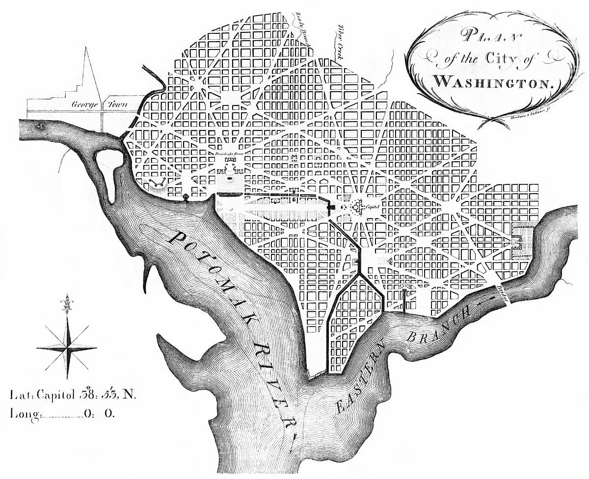
L’Enfant’s original 1791 plan for Washington DC
Civil War Through the Modern Era
During the Civil War, DC’s population grew from 75,000 to 130,000. The federal government built a 37-mile ring of fortifications around the capital: 68 forts and 93 detached batteries. After the war, the city absorbed Georgetown and expanded into surrounding farmland. The first neighborhoods beyond the original L’Enfant boundaries grew around Capitol Hill, the Center Market, and the White House, spreading outward along streetcar lines that crossed the city.
The 1901 McMillan Plan redesigned and extended the National Mall to its current form. DC continued expanding through the 20th century, though the 1968 riots following Martin Luther King Jr.’s assassination devastated U Street and Columbia Heights, accelerating suburban flight that hollowed out the city’s core through the 1970s and 1980s. The turnaround came in the 1990s and accelerated through the 2000s, bringing population growth, development, and a gentrification wave that continues today.
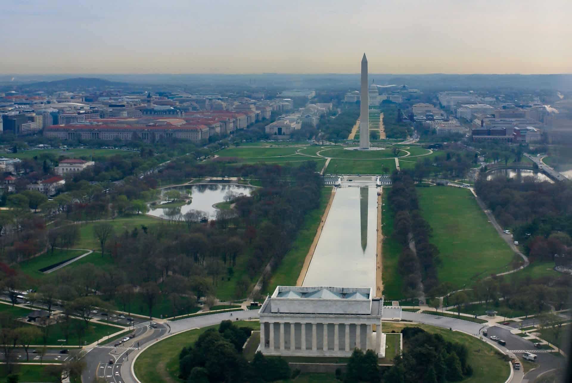
The National Mall with the Lincoln Memorial
DC’s Cultural Identity
Chocolate City, Go-Go, and Mumbo Sauce
DC earned the nickname “Chocolate City” when it became the first large American city with a majority Black population. At its peak in 1970, Black residents made up 71% of the population. Today that figure is around 44%, the result of decades of gentrification pushing long-term residents out of neighborhoods they’d built. The loss is measurable: between 2000 and 2013, an estimated 20,000 Black residents were displaced from the District.
Two things define the culture of Black DC in a way that no Washington Monument or Capitol tour captures. Go-go music is a percussion-forward, call-and-response funk genre born in DC in the 1970s, created by Chuck Brown and carried forward by bands like Trouble Funk, Junk Yard Band, and Rare Essence. It’s the sound of a living city, not a museum exhibit. Mumbo sauce — a sweet-tangy condiment somewhere between barbecue sauce and sweet-and-sour — is the condiment of the carryout counter. Chicken wings with mumbo sauce are a late-night staple, and you find them in the neighborhoods Route 1 passes through, not in the tourist corridors.
Duke Ellington’s DC
Edward Kennedy “Duke” Ellington was born at 2129 Ward Place NW on April 29, 1899. He grew up in DC, started playing around U Street, and went on to a 50-year career that produced hundreds of compositions and earned him the Presidential Medal of Freedom in 1969. DC claims him because DC made him — the U Street jazz scene of the 1920s and 1930s, segregated but extraordinarily creative, was the environment that shaped his sensibility before Harlem’s Cotton Club made him famous.
DC’s Political Paradox
DC residents pay the highest per-capita federal income taxes in the country, more in total than residents of 22 states, and they have no voting representation in Congress. The district elects a non-voting delegate to the House. Congress retains veto power over local laws and local budgets. DC has no control over its own National Guard. The statehood debate has been ongoing since 1790, and if you spend any time in the city’s neighborhoods rather than the monument corridor, you’ll see the “DC Statehood” signs in windows and yards — this isn’t an abstract political argument here, it’s a daily frustration.
The National Mall: What to Prioritize
The Monument Corridor Along Route 1
The National Mall runs roughly two miles from the Capitol to the Lincoln Memorial, flanked by Smithsonian museums on both sides. Everything here is free. The Air and Space Museum draws the biggest crowds; if you go, aim for a weekday morning. The National Museum of African American History and Culture, opened in 2016, has become one of the most visited museums in the country — timed entry passes are required and book out weeks in advance. The National Museum of American History, the Natural History Museum, and the Freer/Sackler galleries are all worth several hours each.
The Lincoln Memorial steps are the stop with the most physical weight. Standing at the top and looking east down the Reflecting Pool toward the Washington Monument, you’re standing where King stood on August 28, 1963. The Korean War Veterans Memorial, the Vietnam Veterans Memorial, and the FDR Memorial all sit within a short walk of the Lincoln Memorial along the western Mall. Budget two to three hours for this cluster alone.
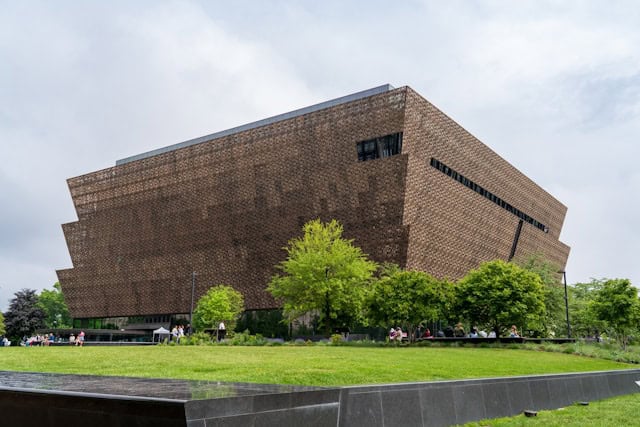
The National Museum of African American History and Culture
DC Neighborhoods Along the Route 1 Corridor
Georgetown
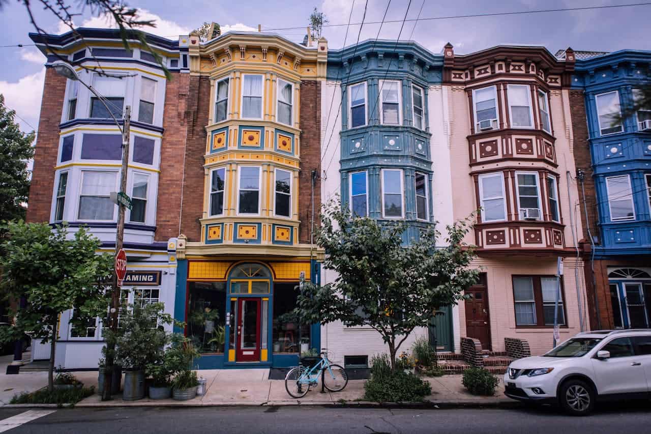
Georgetown predates the District — it was a thriving Potomac port town before it was absorbed into the new capital. Today it’s one of DC’s most expensive neighborhoods, with Federal-era row houses, high-end retail on M Street and Wisconsin Avenue, and Georgetown University anchoring the western end. It’s pleasant to walk but expensive to eat in. For Route 1 travelers, it’s worth an hour or two; it’s not where you’ll find DC’s character.
U Street / Shaw
U Street was “Black Broadway” in the segregated era — the entertainment district where Duke Ellington got his start, where Howard Theater hosted jazz and R&B acts that couldn’t perform downtown, where a self-contained Black commercial and cultural world thrived because it had no alternative. The 1968 riots devastated U Street badly enough that it didn’t fully recover for thirty years. The neighborhood today has gentrified significantly, but the anchor of the corridor is still there: Ben’s Chili Bowl, 1213 U Street NW, open since 1958. The half-smoke is a DC original — half beef, half pork, heavily seasoned and smoked, served in a natural casing. Ben’s stayed open during the 1968 riots to feed civil rights workers and emergency responders. Barack Obama ate here the night before his first inauguration. Order the half-smoke with chili.
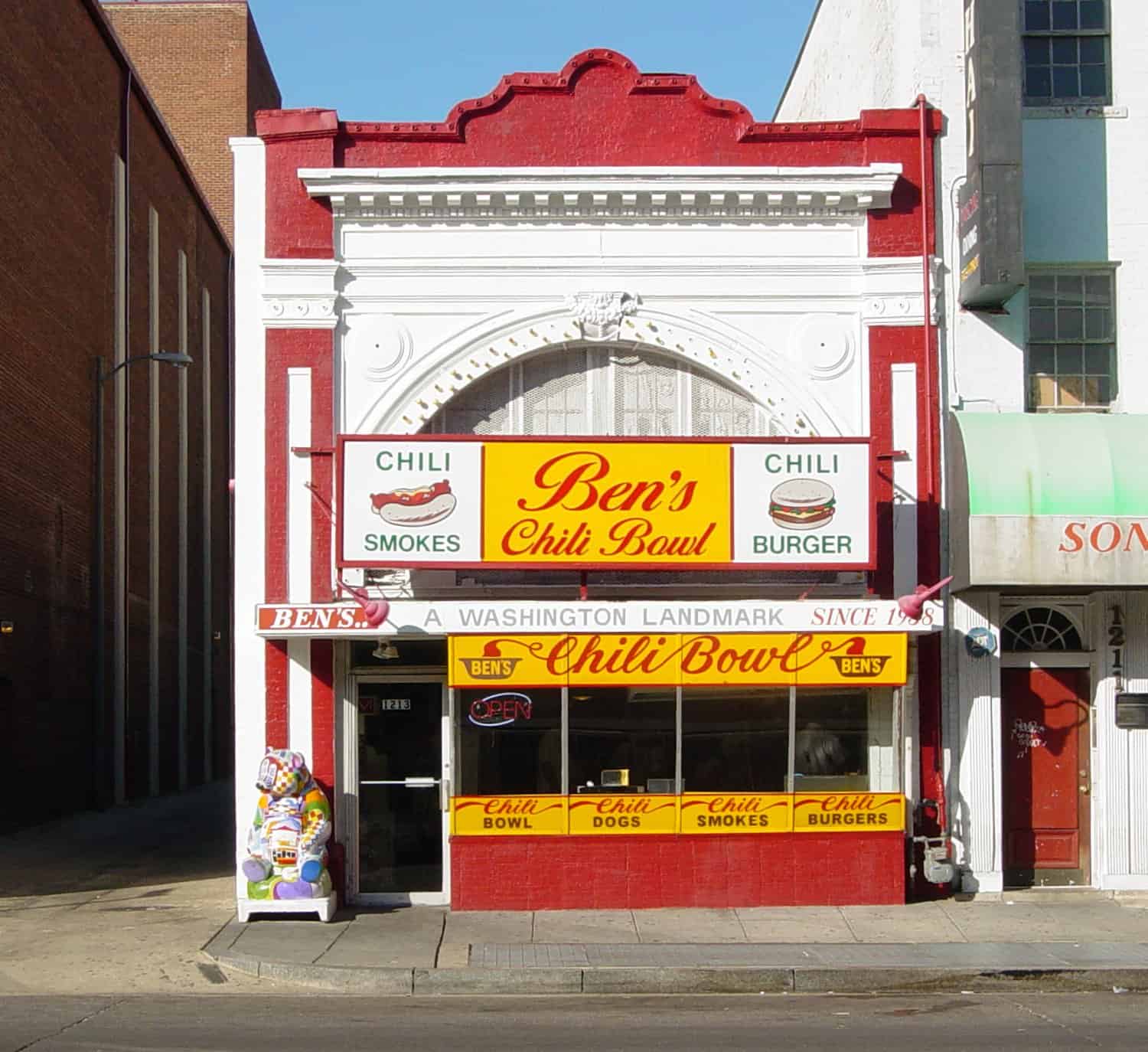
Ben’s Chili Bowl’s iconic storefront on U Street
Capitol Hill
Capitol Hill runs from the Capitol building east to Lincoln Park, lined with 19th-century row houses that now house congressional staffers, lobbyists, and long-time residents watching the neighborhood price them out. Eastern Market, operating since 1873, anchors the residential side of the Hill on weekends: farmers, local produce, handmade goods, a crowd that’s genuinely mixed in a way that few DC spaces are. Barracks Row on 8th Street SE has the restaurants. Tour the Capitol with advance reservations; the Library of Congress next door is undervisited and extraordinary.
Brookland
Route 1’s Rhode Island Avenue exit runs through Brookland, a northeast neighborhood known for the Basilica of the National Shrine of the Immaculate Conception — the largest Catholic church in the United States, with 83 chapels and mosaics covering 80,000 square feet of interior space. A short walk away, the Franciscan Monastery of the Holy Land recreates shrines from Jerusalem, Bethlehem, and Nazareth in a 44-acre complex with catacombs beneath the church. Neither is on most DC itineraries. Both are worth the detour.
Adams Morgan and Columbia Heights
Adams Morgan, on 18th Street NW above U Street, concentrates DC’s Ethiopian restaurants, Salvadoran pupuserías, and late-night bar scene in a dense corridor. Columbia Heights, further north along Route 1’s Georgia Avenue alignment, has been the center of DC’s Latino community for decades and is one of the city’s more genuinely diverse neighborhoods. The Giant grocery store at 14th and Irving is a useful landmark: this corner, now surrounded by apartment buildings and restaurants, was still visibly blighted from the 1968 riots as recently as the mid-1990s.
Places Most DC Visitors Miss
The National Arboretum
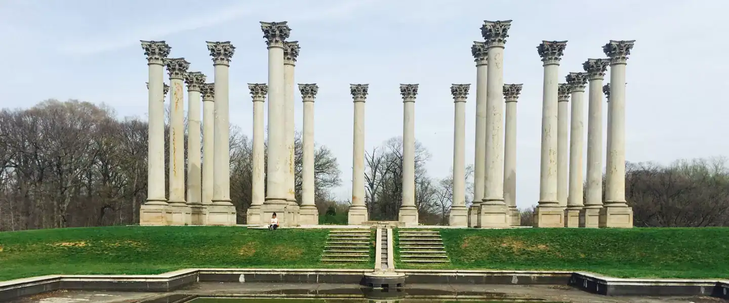
The US National Arboretum sits on 446 acres in Northeast DC, about two miles from the Capitol. It’s open daily, admission is free, and on most weekdays you’ll share it with almost nobody. The standout is the Capitol Columns — 22 original sandstone Corinthian columns removed from the Capitol’s east portico during a 1958 renovation, now arranged in a meadow field as a kind of open-air monument to themselves. They look like a Roman ruin dropped in the middle of a Maryland landscape. The azalea collection in April and May is one of the great spectacles in any city.
Meridian Hill Park
Meridian Hill Park, on 16th Street NW between Columbia Heights and Adams Morgan, is an 12-acre formal park with a 13-basin cascading fountain running down a terraced hillside — the longest continuous cascading fountain in North America. On Sunday afternoons, the drum circle that has gathered here for decades starts mid-afternoon and runs into the evening. It’s one of those DC institutions that locals don’t feel the need to explain to outsiders. If you’re in the city on a Sunday, go.
Rock Creek Cemetery and the Adams Memorial
Rock Creek Cemetery, on Webster Street NW in Petworth, has operated since 1719. It holds the Adams Memorial, commissioned by historian Henry Adams in 1891 after the death of his wife. The bronze figure, created by Augustus Saint-Gaudens and set into a curved granite exedra designed by Stanford White, is one of the great sculptures in American art. Henry Adams called it “The Mystery of the Hereafter.” Mark Twain said it was “the most impressive thing in America.” It sits in a quiet corner of a working cemetery with no gift shop or signage explaining why it matters. Finding it is part of the experience.
Route 1: The State’s Eastern Thread
Baltimore Avenue: The Historic Highway
US 1 enters Maryland from DC as Rhode Island Avenue, which merges into Baltimore Avenue after about a mile in Hyattsville. Before I-95, this was the main route between Washington and Baltimore — the road that connected the two cities for over a century. During World War II, the alignment was shifted from Baltimore Avenue and Bladensburg Road to Rhode Island Avenue, which was widened to 36 feet in 1940. The old alignment became US 1 Alternate, still signed today through Bladensburg and College Park.
The Georgia Avenue alignment of Route 1 through DC traces a different history: it runs through Petworth and Brightwood, neighborhoods that were predominantly white suburbs in the early 20th century, became majority Black communities by mid-century, and have been gentrifying since the 2000s. The Route 1 corridor here is not the DC of the monuments and the Mall. It’s the DC where people live, where the carryouts serve mumbo sauce, where the barbershops have been on the same corner for forty years. That DC is also worth your time.
Share your Washington DC route 1 memory
Do you have a story you would like to share? We want to hear it!
Create a View to tell a unique story about a specific place
Want to see what others wrote about Washington DC?
Our Travel map has over 1400 posts from users like you
We have 2 types of content at Route1views:
- View: A unique experience at a single location
- Trip: A collection of experiences at different places, connected through a ‘road trip’
- Most first-time posters choose to make a View
A note about Route 1 Views
We are a user-driven social media site for celebrating and sharing stories along historic Route 1 USA. Using our platform is FREE forever and we don’t play any tricks. We don’t share your data or spam you with emails. We are all about sharing!


The Route 1 Road Trip Coloring Book
36 pages · 13 states · a color-as-you-drive map. Free — print it at home.
36 pages · no email required · print at home
Want a peek inside first? See everything →It's yours — enjoy! 🖍️
No email, no strings. By the way — want the occasional Route 1 story and first dibs on the next freebie? Totally optional.
You're in — thanks! 🖍️

 Continue with Google